
படிமம்:LocationSouthAfrica.png
இதைவிட அளவில் பெரிய படிமம் இல்லை.
LocationSouthAfrica.png (250 × 115 படவணுக்கள், கோப்பின் அளவு: 5 KB, MIME வகை: image/png)
Afrikaans: 'n Geografiese kaart om die posisie van Suid-Afrika aan te dui.
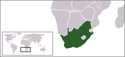
English: Location map for South Africa.
Čeština: Poloha Jihoafrické republiky.
Originally created for English Wikipedia by Vardion.
| |
This work has been released into the public domain by its author, Vardion, at the [[::|ஆங்கிலம் விக்கிப்பீடியா]] project. This applies worldwide. In case this is not legally possible: |
Template loop detected: Template:Autotranslate <includeonly></includeonly>
கோப்பின் வரலாறு
குறித்த நேரத்தில் இருந்த படிமத்தைப் பார்க்க அந்நேரத்தின் மீது சொடுக்கவும்.
| நாள்/நேரம் | நகம் அளவு சிறுபடம் | அளவுகள் | பயனர் | கருத்து | |
|---|---|---|---|---|---|
| தற்போதைய | 03:23, 13 திசம்பர் 2004 | | 250 × 115 (5 KB) | EugeneZelenko | Location map for the South Africa.<br/>Originally created for English Wikipedia by Vardion.<br/>{{PD}}<br/>Category:Country locator maps |
கோப்பு பயன்பாடு
பின்வரும் 14 பக்கங்கள் இணைப்பு இப் படிமத்துக்கு இணைக்கபட்டுள்ளது(ளன):
- ஆப்பிரிக்க தேசியக் காங்கிரசின் நூற்றாண்டு விழாவில் தமிழ்க் கூட்டமைப்பு கலந்து கொண்டது
- தென் ஆப்பிரிக்க தொடருந்து விபத்தில் குறைந்தது 14 பேர் பலி
- தென்னாப்பிரிக்க முன்னாள் தலைவர் நெல்சன் மண்டேலாவுக்கு தொடர்ந்து சிகிச்சை
- தென்னாப்பிரிக்காவின் அரசுப் பள்ளிகளில் மீண்டும் தமிழ் மொழிப்பாடம் கற்றுத் தரப்படும்
- தென்னாப்பிரிக்காவில் 1960 சார்ப்வில் படுகொலை நினைவுகூரப்பட்டது
- தென்னாப்பிரிக்காவில் பேருந்து விபத்தில் 24 பேர் உயிரிழப்பு
- தென்னாப்பிரிக்காவில் முதியோர் இல்லம் ஒன்று தீப்பற்றியதில் 18 பேர் இறப்பு
- தென்னாப்பிரிக்காவில் விருத்த சேதனம் செய்த 20 சிறுவர்கள் உயிரிழப்பு
- தென்னாப்பிரிக்காவில் வெள்ளையின மேலாதிக்கவாதிகளின் தலைவர் படுகொலை
- தென்னாப்பிரிக்காவில் வேலை நிறுத்தத்தில் ஈடுபட்ட தொழிலாளர்கள் மீது சூடு, 34 பேர் உயிரிழப்பு
- நெல்சன் மண்டேலா விடுதலையின் 20 ஆண்டு நிறைவு கொண்டாடப்பட்டது
- நெல்சன் மண்டேலாவின் உடலுக்கு உலகத் தலைவர்கள் அஞ்சலி
- மகாத்மா காந்தியின் அஸ்தி தென்னாப்பிரிக்காவில் கரைக்கப்படுகிறது
- வார்ப்புரு:தென்னாப்பிரிக்கா
கோப்பின் முழுமையான பயன்பாடு
கீழ்கண்ட மற்ற விக்கிகள் இந்த கோப்பை பயன்படுத்துகின்றன:
- ar.wikinews.org-திட்டத்தில் இதன் பயன்பாடு
- قالب:جنوب أفريقيا
- جنوب أفريقيا تفرض ملصقات لتمييز بضائع الأراضي المحتلة عن المصنوعة في إسرائيل
- قيادة الشرطة في بيترماريتزبرغ توقف اختبارات القبول بعد وفاة سبعة مرشحين
- رئيس جنوب إفريقيا يدعو مواطنيه للامتناع عن زيارة "إسرائيل"
- حماس تشيد بدعوة رئيس جنوب إفريقيا عدم زيارة "إسرائيل"
- اعتماد المجلس الوطني الفلسطيني عضواً مراقباً في البرلمان الإفريقي
- جنوب إفريقيا تعلن مقاطعتها القمة الإفريقية-"الإسرائيلية"
- حفيد مانديلا: فلسطين تعاني من أسوأ أنواع الأبارتهايد
- أغنية كأس أمم أفريقيا تحتفي بالسلام
- bpy.wikipedia.org-திட்டத்தில் இதன் பயன்பாடு
- br.wikipedia.org-திட்டத்தில் இதன் பயன்பாடு
- br.wiktionary.org-திட்டத்தில் இதன் பயன்பாடு
- ca.wikipedia.org-திட்டத்தில் இதன் பயன்பாடு
- ceb.wikipedia.org-திட்டத்தில் இதன் பயன்பாடு
- de.wikipedia.org-திட்டத்தில் இதன் பயன்பாடு
- Bontebok-Nationalpark
- Addo-Elefanten-Nationalpark
- Mountain-Zebra-Nationalpark
- West-Coast-Nationalpark
- ISimangaliso-Wetland-Park
- Augrabiesfälle
- Tsitsikamma-Nationalpark
- Goegap Nature Reserve
- Namaqua-Nationalpark
- Anysberg Nature Reserve
- Tankwa-Karoo-Nationalpark
- De Mond Nature Reserve
- Oorlogskloof Nature Reserve
- Grootvadersbosch Nature Reserve
- Rocherpan Nature Reserve
- Golden-Gate-Highlands-Nationalpark
- Akkerendam Nature Reserve
- Marloth Nature Reserve
- De Hoop Nature Reserve
- Gamkaberg Nature Reserve
- Bird Island Nature Reserve
- Midmar Nature Reserve
- Hluhluwe-iMfolozi-Park
- Karoo-Nationalpark
- Knysna National Lake Area
- Mapungubwe-Nationalpark
- Marakele-Nationalpark
- Tafelberg-Nationalpark
- Wilderness-Nationalpark
- Agulhas-Nationalpark
- Caledon Nature Reserve (Freistaat)
- Mokala-Nationalpark
- Camdeboo-Nationalpark
- Garden-Route-Nationalpark
- Tembe Elephant Park
சிறப்பு பக்கம்-மொத்த பயன்பாடு - இதன் மூலம் இந்த கோப்பின் மொத்த பயன்பாட்டை அறிய முடியும்